- #=527 QS Global World Ranking
- PublicStatus
- Very HighResearch Output
- 20,254Total Students
- 2,295Faculty
- 1,887Int'l Students
The University’s position in the current QS World University Rankings.
Whether the University is funded by the government of that country or state, or funded by private donations.
The research intensity of the University, based on the number of papers output relative to the University’s size.
The number of full time equivalent students enrolled at the University.
The number of full time equivalent teaching staff employed by the University.
The number of full time equivalent international students enrolled at the University.
Warsaw University of Technology
About
Master Study Program Mobile Mapping and Navigation
Webpage: https://zk.gik.pw.edu.pl/mmns
Contact: joanna.kossakowska@pw.edu.pl
Key information:
Duration: 18 months (1.5 years)
Language: English (English requirements)
Apply dates for international students: 15.04.2020 - 15.07.2020
https://www.students.pw.edu.pl/index.php/How-to-Apply/Admission-to-M.Sc
Tuition fee for international students: 1000 EUR/semester
Apply dates for Polish students: 3.08.2020-28.08.2020
https://www.zapisy.pw.edu.pl/
Tuition fee for Polish students: 1100 PLN/semester
Start date: 1st October...
Read more
Master Study Program Mobile Mapping and Navigation
Webpage: https://zk.gik.pw.edu.pl/mmns
Contact: joanna.kossakowska@pw.edu.pl
Key information:
Duration: 18 months (1.5 years)
Language: English (English requirements)
Apply dates for international students: 15.04.2020 - 15.07.2020
https://www.students.pw.edu.pl/index.php/How-to-Apply/Admission-to-M.Sc
Tuition fee for international students: 1000 EUR/semester
Apply dates for Polish students: 3.08.2020-28.08.2020
https://www.zapisy.pw.edu.pl/
Tuition fee for Polish students: 1100 PLN/semester
Start date: 1st October 2020
Key Words: mobile mapping, navigation systems, geodesy, cartography, GIS, remote sensing, photogrammetry, computer vision, GPS, GNSS, INS, SLAM
Disciplines: Geodesy, Geomatics, Geoinformation Science, Earth Sciences, Cartography, Informatics & Information Sciences, Web Technologies & Cloud Computing
Overview
With this Mobile Mapping and Navigation Systems program from Warsaw University of Technology you will learn the principles of designing, developing and using mobile measurement platforms and mobile mapping systems (MMS), how to design location-based systems (LBS) and navigation applications (GNSS, GNSS/INS) and how to choose appropriate techniques for acquiring spatial data (photogrammetry, remote sensing, computer vision).
Furthermore, you will gain a comprehensive knowledge about outdoor (self-driving car, UAV) and indoor navigation systems. Finally, you will be trained on how to integrate and process the data from multiple sensors for navigation applications. You will create technologies of the future.
Programme structure, Courses content:
Positioning systems: Reference Systems for Navigation, Satellite Navigation Systems, Indoor and Outdoor Navigation (algorithms, applications), Integrated Navigation System
Data acquisition: Mobile Mapping Technologies, Modern Photogrammetry, Geo-data Standards, Field Practices
Algorithms and applications: Programming Language with Numerical Methods, Algorithms of Navigation Applications, Image Recognition and Deep Machine Learning, Intelligent Transportation Systems and Autonomous Cars, Simultaneous Localization and Mapping (SLAM),
Spatial Analysis: Spatial Data Mining and Big Data, Urban Solutions for Autonomous Vehicles, Visualisation and data modelling:
3D Modelling and Cartography: Augmented Reality, Computer Vision and 3D Data Processing, Mobile and Navigational Cartography,
Building Information Modelling
Studies last 3 semesters and consist of lectures and practical classes. Studies conclude with the composition of a diploma thesis which must be presented orally before an examination board.
University highlights
- 2012#601+
- 2014#601-650
- 2015#651-700
- 2016#651-700
- 2017#601-650
- 2018#601-650
- 2019#601-650
- 2020#521-530
- 2021#511-520
- 2022#501-510
- 2023#521-530
- 2024#=571
- 2025#=527
Campus locations
Pl. Politechniki 1, Warsaw , PL,
Pl. Politechniki 1 , Warsaw , Poland , 00-661
Similar Universities
The Hong Kong University of Science and Technology
Clear Water Bay, Kowloon
32 QS World University RankingsKarlshochschule International University
Karlsstr. 36-38, Karlsruhe
Prague University of Economics and Business
W.Churchill Sq. 4, Prague
Universidad de las Américas Puebla (UDLAP)
Ex Hacienda Santa Catarina Martir, Cholula
751-800 QS World University Rankings 5 QS starsErasmus School of Economics
Burgemeester Oudlaan 50, Rotterdam
Related content

The Top Christmas Markets in…

Warsaw

Top Mechanical Engineering S…

Top Mechanical Engineering S…

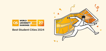
QS Best Student Cities 2024:…
Test preparations
Featured University


-
10 UG & 47 PGTotal courses
-
PrivateStatus
-
HighResearch output